Skip to content
Would you like to have an up-to-date Street View Blue Line around your Google Business Profile?
You cannot order a Google car… but you can order Digisolu! 😉
A Street View Blue Line is the solution for the correct navigation of cars and pedestrians to a specific location in maps
Do you need to map your surroundings anew in Google Maps to improve your business?
Do you have incorrectly drawn roads/paths in your vicinity?
We offer mapping of roads / paths – Street View Blue Line
Price: 5000 CZK or 218 € / 1 km (price for additional km is calculated per 0.5 km)
The client pays for the time dedicated to capturing the Street View Blue Line
The result is a Street View Blue Line in Google Maps in 8K resolution
All copyrights for the Street View Blue Line in Google Maps belong to Digital Solution Marketing z. s.
When sharing the Blue Line, the client adheres to the principles/conditions
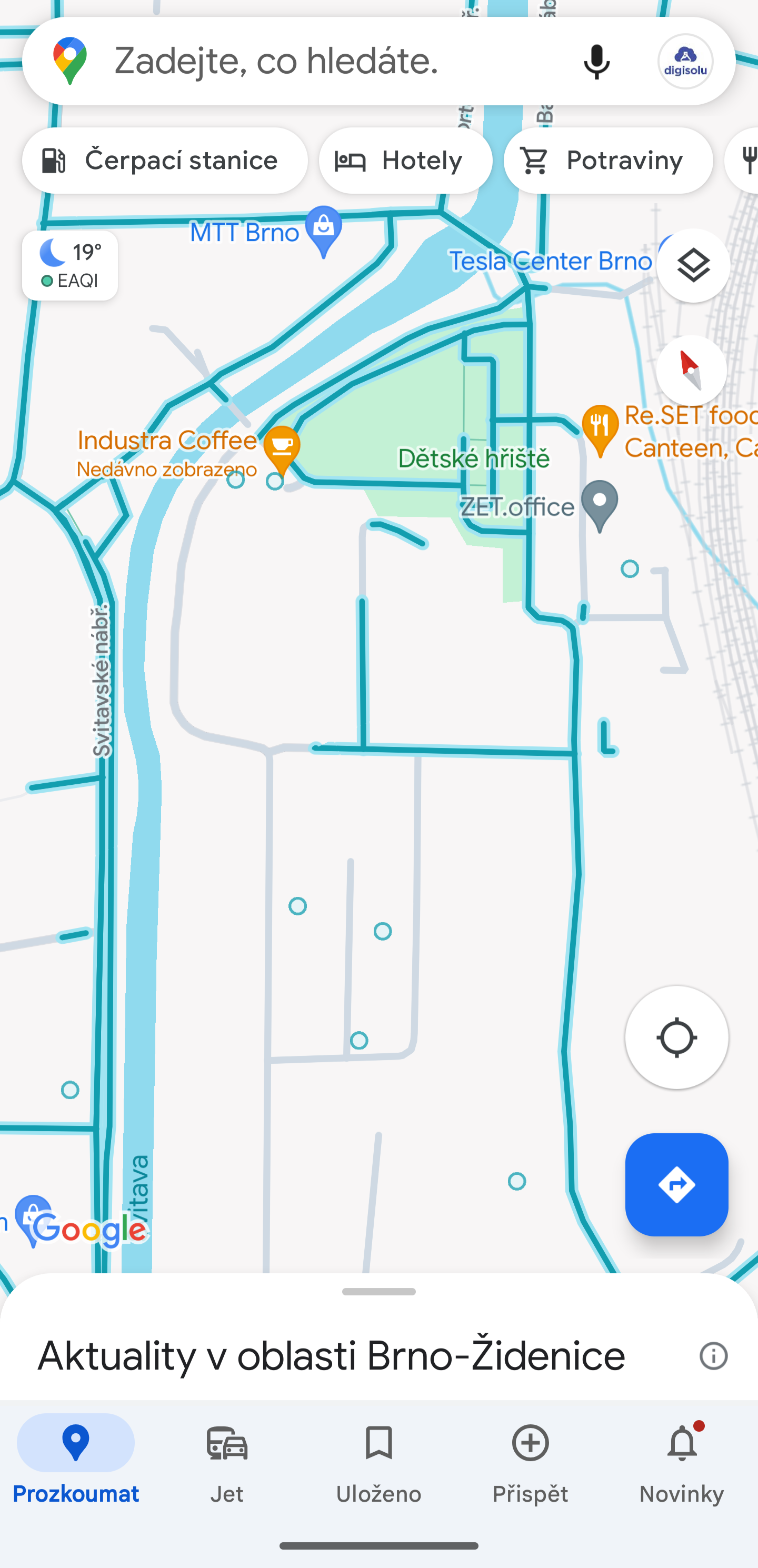
Sample Street View Blue Line by Digisolu – Mapping Planets Brno 2025
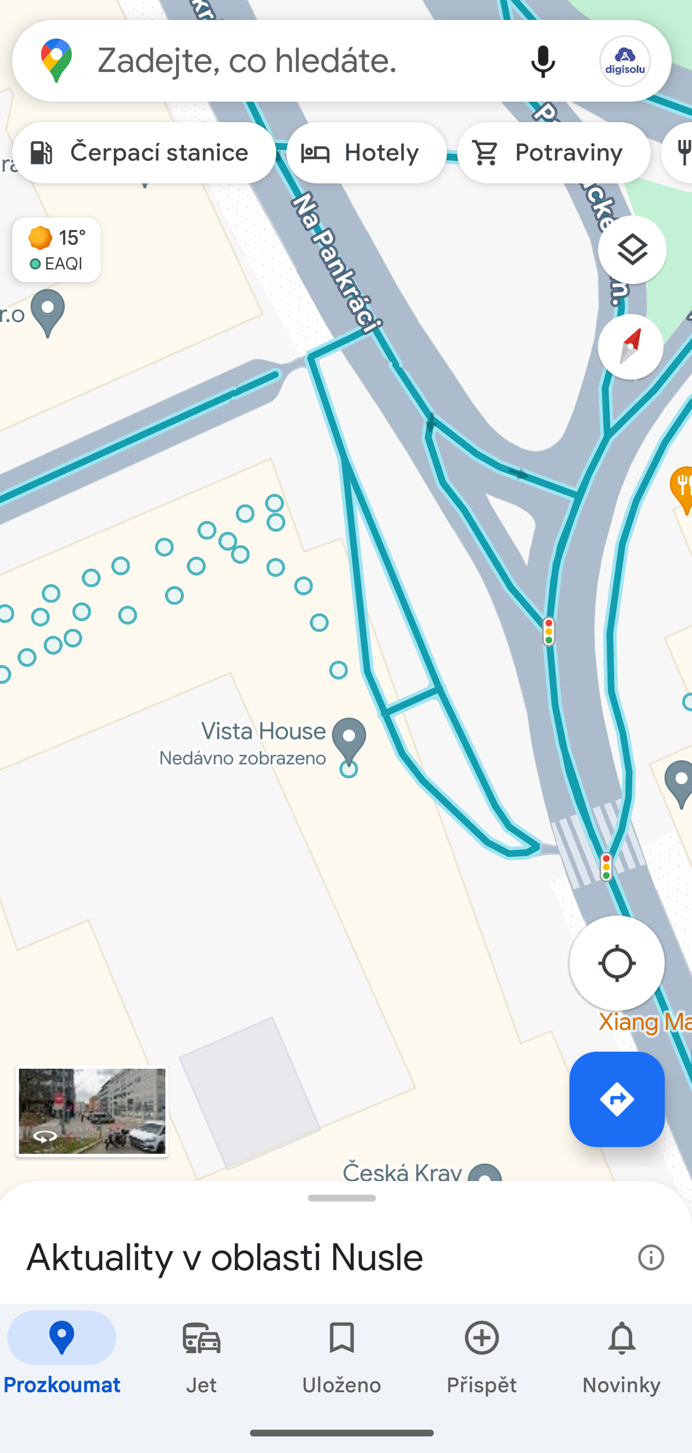
Sample Street View Blue Line by Digisolu – Mapping Vista House – Prague
Sample Street View Blue Line by Digisolu – Industra – Curling Brno – Nová Zbrojovka Complex – Brno
Is a drawn road missing in your vicinity in Google Maps?
Would you like clients, deliveries, etc., to find you better?
Improvement of routing / navigation in maps
Price includes:
– communication with Google
– road segment – 1 ticket
The goal is to draw the correct road/path after previously capturing the Blue Line into Google Maps
The goal is to delete non-existent roads/paths
Price: 5000 CZK or 218 €
Didn’t find a service package that suits you?
Write to zdenek@digitalsolution.marketing
We will create a package tailored to your needs 😉
Dealing with Google Business Profile issues?
We are happy to help, check out the service packages – Google Business Profile Troubleshooting
All payments for work are made in advance, the client agrees to the set package
We are not VAT payers.
Invoicing to the EU – Tax paid by the customer
Invoicing outside the EU – Tax paid by the customer
Introductory meeting – video call is free
– we discuss the status of your Google Business Profile at the meeting – subsequently, we propose the best solution
We operate all over the world to make more people happy 😉
Service package offer valid from January 1 2026
Street View Blue Line
The Street View Blue Line is a feature in the Google Maps app that allows you to explore the world through 360-degree photos. These photos are taken by cameras mounted on cars, mopeds, hikers, and even balloons. The Street View Blue Line is available in more than 200 countries and 90 languages.
Difference between Street View Blue Line and 360 Virtual Tour
The main difference between the Street View Blue Line and a 360 Street View virtual tour is that the Street View Blue Line is available in public places, while the 360 Street View virtual tour is also available in private places. The 360 Street View virtual tour is based on photos taken by a camera built into a device such as a smartphone or tablet.
When to use the Street View Blue Line
You can use the Street View Blue Line when you want to explore public places such as streets, parks, monuments, and museums. You can also use the Street View Blue Line to prepare for a trip. You can view the surroundings of your hotel or hostel and find out how to get there.
Sušenky nastavení